The Coves d'Artà were mapped by early surveyors and became a set-piece of the Romantic tour, which is how they entered European writing.
The cave that Europeans came to see
The coast east of Artà drops into limestone cliffs that the sea has been undercutting since long before anyone thought to measure them. Behind one of those cliffs, at Cap Vermell near the hamlet of Canyamel, the Coves d'Artà open into a sequence of chambers large enough to have swallowed a small cathedral — and, for a particular generation of northern European travellers, they served roughly that function: a sublime interior, dark and dripping, that confirmed everything the Romantic sensibility expected of a Mediterranean island.
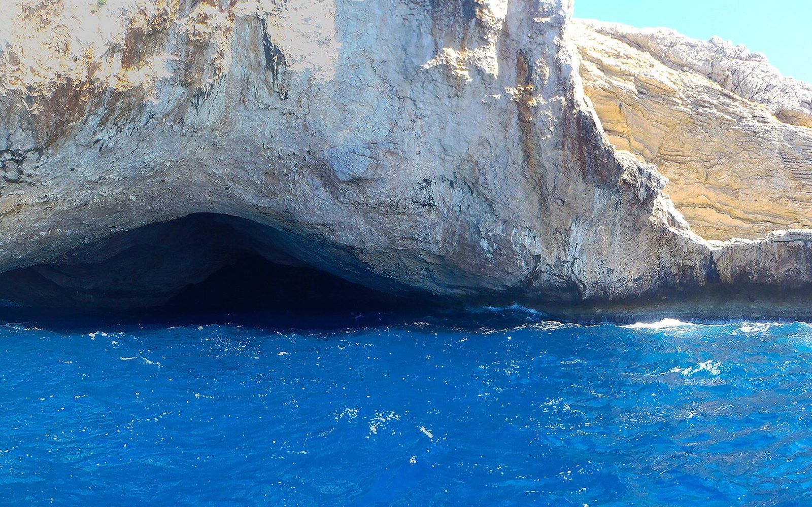
The cave system faces the sea directly. The main entrance is a wide, high arch at the base of the cliff, and at certain angles the light carries far enough inside to illuminate the first chamber without a lamp. That visibility from the water made the caves a landmark for sailors long before they became a destination for tourists, and it shaped the way they were first recorded: not from a map but from a ship's log, as a hazard and a reference point on a difficult coast.
What changed in the nineteenth century was the ambition of the survey. The geographer and cartographer Édouard Martel visited Mallorca in the 1890s and brought with him the methods of systematic speleology — the measurement of chambers, the sketching of cross-sections, the recording of stalagmite and stalactite formations as a geological rather than merely a scenic inventory. Martel had already mapped caves across France and was in the process of establishing cave science as a discipline. His work at the Coves d'Artà was part of a wider Balearic survey, and it produced the first technically credible ground plan of the system: chamber dimensions, ceiling heights, the relationship between the sea entrance and the deep interior.
What the surveys found
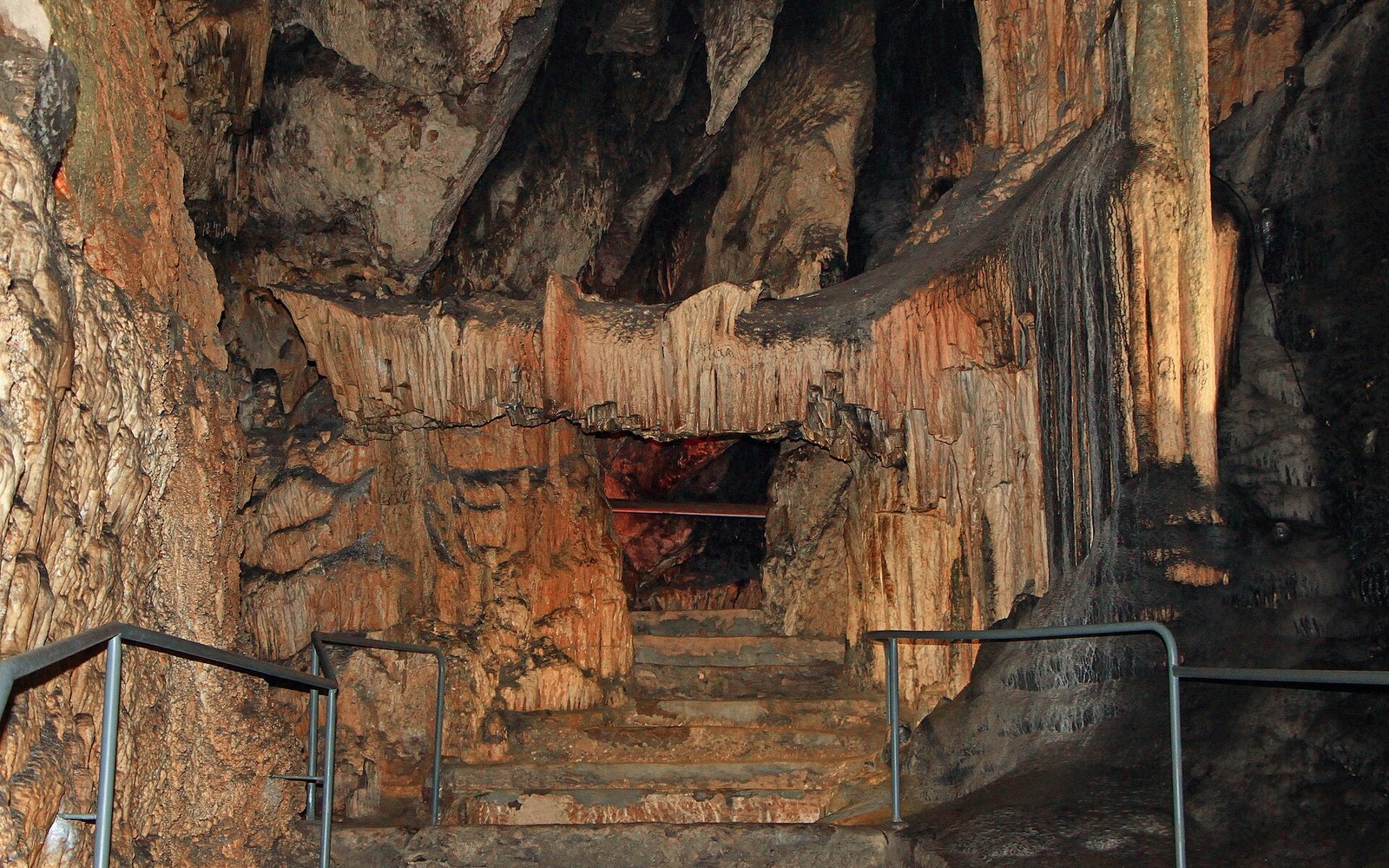
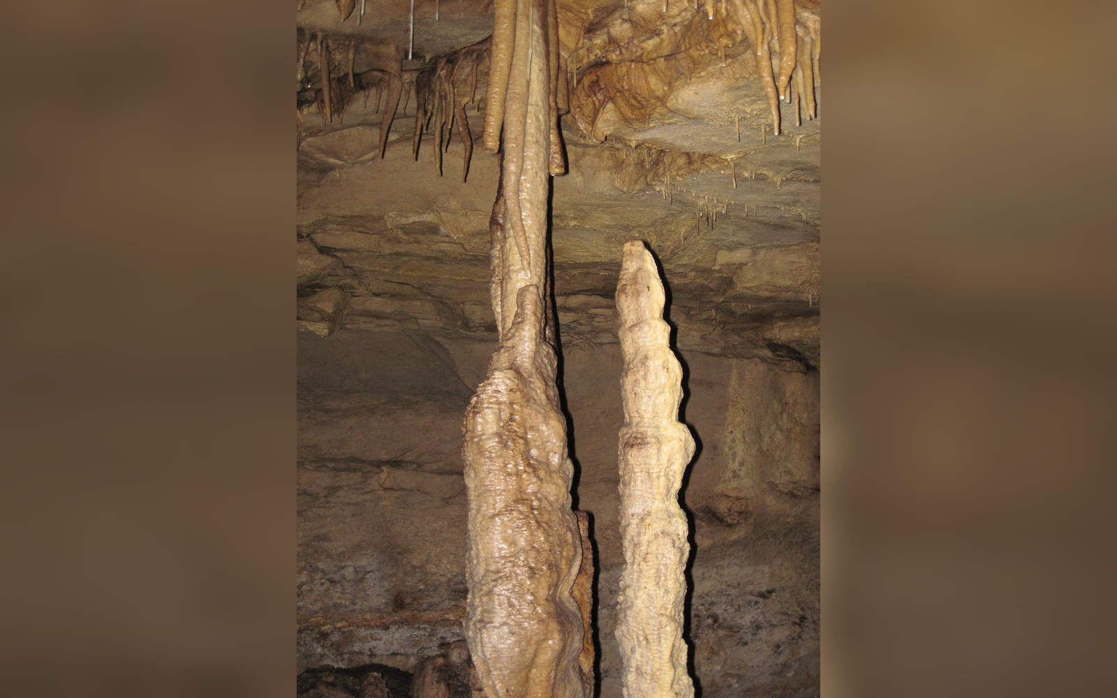
The system runs roughly inland from that sea-facing arch, and the chambers deepen and narrow as they go. The first and largest space, known as the Vestíbul, is high enough that its ceiling disappears into darkness above a visitor standing at the floor. The formations inside are substantial — some of the stalagmites are among the tallest recorded in any Spanish cave, and several columns have formed where rising stalagmites and descending stalactites have met and fused over timescales that the growth-rate measurements make legible. The cave floor is uneven and calcite-encrusted in ways that made early traversal without artificial light genuinely dangerous.
Martel's surveys established the broad dimensions that later twentieth-century work confirmed and refined. The cave is now understood as a dissolution feature in coastal limestone, carved primarily by freshwater moving downward through the rock along joints and bedding planes, with sea-level changes over geological time affecting which passages flooded, which drained, and which received the drip-water that built the formations. The sea entrance itself, and the marine erosion that enlarged it, is a secondary feature: the interior was already formed when the cliff face retreated far enough to open it.
The caves had entered the consciousness of educated European travellers somewhat earlier.
That layered history — freshwater dissolution, then marine modification, then the long stillness of a sealed space — is what gives the chambers their particular character. The formations are not evenly distributed. The deepest sections, furthest from the sea and from seasonal moisture variation, carry the densest and most elaborate calcite structures, while the entrance chambers are scoured and relatively bare.
The Romantic tour and its written record
By the time Martel arrived with his instruments, the Coves d'Artà had already accumulated a literary reputation. The Archduke Ludwig Salvator of Austria — the Habsburg naturalist ↗ who spent decades documenting the Balearic Islands and produced his encyclopaedic Die Balearen between 1869 and 1891 — included detailed descriptions of the caves that ran well beyond the purely geological. His account registers the formations as spectacle: the play of torchlight on wet calcite, the acoustic peculiarities of the larger chambers, the sense of scale that made the space feel both geological and theatrical.
The caves had entered the consciousness of educated European travellers somewhat earlier. Accounts from the mid-nineteenth century describe organised visits by lamplight, with local guides who understood which routes were passable and which formations were safe to touch — a distinction that not all visitors respected. The infrastructure of the Romantic cave visit, in other words, was already in place before any systematic scientific survey: the guides, the lamps, the sense that one was seeing something singular.
That prior reputation shaped what Martel and his contemporaries wrote. The scientific survey did not replace the Romantic response; it ran alongside it. The measurements gave the awe a frame of reference. A chamber that felt immense could now be stated to be immense by specific dimensions, which paradoxically intensified rather than reduced its effect on readers who had not been there. The caves entered European geographical and literary culture in this double register — as a measurable fact and as an experience that exceeded measurement.
George Sand had visited Mallorca in the winter of 1838–39, staying at the monastery of Valldemossa, and her account of the island, Un hiver à Majorque, shaped expectations for subsequent visitors. She did not herself describe the Coves d'Artà in detail, but her framing of the island as a place of extreme landscape, dramatic geology and difficult weather primed the literary tourist to seek out exactly such interiors. The caves fitted the template she had helped create.
What the nineteenth century left behind
The documentary inheritance of those surveys is substantial and uneven. Ludwig Salvator's Die Balearen ↗ survives in its original volumes and has been partially digitised, giving access to his cave descriptions alongside the illustrations that made the work so widely cited. Martel's speleological records fed into the scientific literature of the emerging discipline and established benchmarks against which twentieth-century re-measurement could work. Together, these sources make the Coves d'Artà one of the better-documented cave systems in the western Mediterranean for the pre-photographic period.
Key
- Mallorca
- Mediterranean
- This piece
- ●Artà · Coves d'Artà — the town itself, and the caves in the cliff east of it
The caves are now managed as a visitor site under the authority of the municipality of Capdepera — not Artà, despite the name — and the path system and lighting installed through the twentieth century have made the formations accessible without the physical risk that early visitors accepted as part of the experience. The artificial lighting is coloured in ways that the original surveyors would not have recognised, and the guided route does not penetrate every section that Martel measured. But the chambers are the chambers, the formations grow at the same imperceptible rate they always have, and the sea entrance still reads from the water as a dark arch in pale cliff — exactly as the sailors logged it, and exactly as the Romantic travellers hoped to find it.
The name has outlasted the jurisdiction: the caves belong administratively to Capdepera, but they are the Coves d'Artà, and have been since the first surveyors wrote them down.