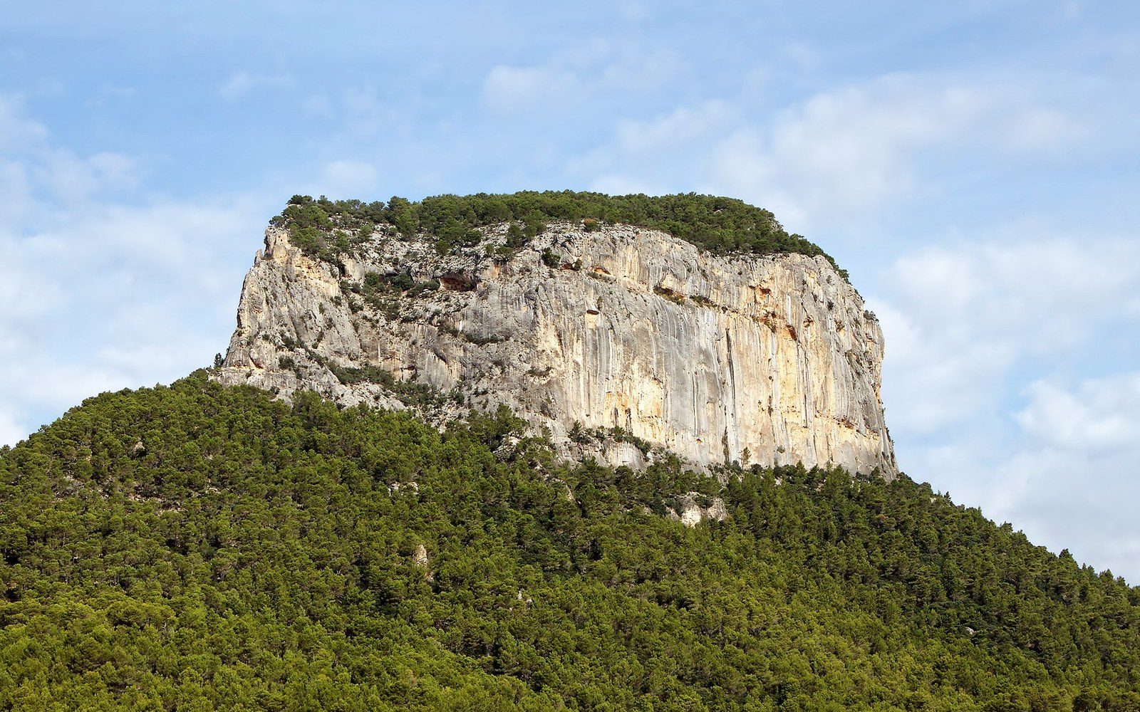
The UNESCO listing for the Serra de Tramuntana is not about scenery. It is about the walls.
What the listing is actually for
The Serra de Tramuntana runs the length of Mallorca's northwestern coast, a limestone ridge that rises to nearly 1,500 metres at Puig Major and drops sharply into the sea along most of its length. The range is dramatic to look at, and the Romantic travellers who came through Valldemossa and Sóller in the nineteenth century made sure everyone knew it. But when UNESCO added it to the World Heritage List in 2011 ↗ as a cultural landscape, the designation was precise: what the committee recognised was not the geology, not the views, not the endemic plants, but the accumulated human engineering layered across the slopes — the terracing, the water management, the charcoal platforms, the network of stone structures through which a mountain population had squeezed a living from very difficult land for at least a thousand years.
The category matters. A cultural landscape is a living or historic interaction between people and environment, rather than a site of natural beauty or geological significance. The Tramuntana was listed alongside places such as the rice terraces of the Philippine Cordillera and the Lavaux vineyards of Switzerland — all places where the feature worth protecting is the work, not the raw material. The implication is uncomfortable: if the work stops, the landscape degrades, and the designation becomes a record of something lost rather than a guarantee of something kept.
The range's geology is karstic limestone, which means rainwater does not collect in streams but drains through fissures into underground aquifers below the rock. The surface is steep and thin-soiled. To grow anything — olives, carob, almonds, a kitchen garden — you had to hold the slope back long enough for soil to accumulate, and hold it with material you could quarry on the spot. The result, over centuries of Muslim and then Christian settlement, was a comprehensive system of dry-stone retaining walls running across the gradients in horizontal ribbons, creating level planting terraces where there had been bare hillside. The technique is known locally as pedra en sec, literally dry stone, and the UNESCO listing for the Tramuntana is in large part a recognition of its scale and sophistication.
The engineering behind the scenery
The walls themselves are the simplest element. They require no mortar: the stones are carefully chosen and laid so that the structure can flex slightly without losing integrity, and so that groundwater can drain through rather than building up pressure behind the face. A well-built wall of this type can stand for generations without maintenance; a neglected one can collapse in a single wet winter. The terraces behind them do two things simultaneously — they stop the thin soil from washing downhill, and they slow the movement of rainwater across the surface, giving it time to infiltrate rather than run off. This is not a small contribution on an island where groundwater is the primary freshwater source and where aquifer recharge depends on precipitation soaking into the limestone rather than streaming into the sea.
Above the terraces, the Tramuntana's water management becomes more elaborate. The mountain villages — Sóller, Valldemossa, Deià, Fornalutx — sit on spring lines where water emerges from the rock. Around these springs, historic hydraulic systems of channels, cisterns, and storage tanks distributed water to different uses: irrigation first, then mills, then domestic supply. Some of these systems still function. The orange groves of the Sóller valley, still producing fruit sold under local names, are irrigated by a network whose basic geometry has not changed substantially since the medieval period, even where individual components have been renewed.
Many are still standing as structures, though their agricultural function has contracted or stopped entirely.
Higher still, on the rocky ground above the tree line, the charcoal platforms are a different kind of evidence. A sitja — a circular stone-banked platform on which timber was stacked and slow-burned to produce charcoal — was the infrastructure of the pre-fossil-fuel economy. Charcoal from the Tramuntana fuelled Palma's bakeries and metalworkers for centuries. The platforms survive in large numbers precisely because they are made of stone and because nobody has had reason to remove them. They appear now as neat circles in the scrub, legible to anyone who knows what they are looking for, illegible to everyone else.
The possessió — the large agricultural estate that dominated Mallorcan land use from the medieval period onward — is also part of what UNESCO listed. These estates were self-contained productive units, typically with a main house, workers' quarters, threshing floor, oil press, and the surrounding terraced and irrigated land that the whole system depended on. Many are still standing as structures, though their agricultural function has contracted or stopped entirely. The landscape they helped shape has not changed as fast as the economy that made it.
Why the listing is a problem as much as a prize
UNESCO recognition brings prestige and, in principle, an obligation on the Spanish government to protect the site's outstanding universal value. What it does not bring is maintenance crews. The terraces require continuous upkeep: individual stones fall and must be reset before a collapse spreads; vegetation that would destabilise the walls must be managed; soil that migrates downhill must be replaced at the upper face. For as long as the terraces were economically productive — supporting olive and almond crops, kitchen gardens, livestock pasture — farmers repaired them because letting them go was costly. As agricultural margins shrank across the twentieth century and rural populations moved toward tourism employment in the coastal towns, the economic incentive to maintain the terraces collapsed along with the demographic capacity to do so.
The result is a landscape in which some terraces are immaculate, some are deteriorating at an accelerating rate, and some have already lost their walls to decades of neglect. The UNESCO listing identifies what is at stake without automatically providing the means to address it. The Balearic government and the Consell de Mallorca have run programmes to support dry-stone restoration, training new practitioners and subsidising repair on agricultural land, but the scale of the need consistently exceeds what the programmes deliver. A landscape that took a thousand years to build cannot be maintained by a handful of subsidised courses.
The range's northwestern face, which drops toward Cap de Formentor and the coast, is also the face most exposed to winter storms driving in from the north. Erosion pressure here is higher than on the sheltered inland slopes, and the terraces on exposed gradients are exactly those most likely to be abandoned when farm income falls. The listing boundary includes these areas; the maintenance capacity does not follow that boundary.
None of this diminishes what is there to see. Walking the GR 221, the long-distance route that threads through the Tramuntana from Port d'Andratx to Pollença, puts you directly alongside the walls, the sitges, the water channels and the olive groves that are the actual subject of the designation. It is one of the few ways to read a UNESCO listing as a landscape rather than as an administrative document. The walls are old, they are intricate, and some of them are falling. The listing explains why that matters.